|
|||||||||||||
|---|---|---|---|---|---|---|---|---|---|---|---|---|---|
|
|||||||||||||
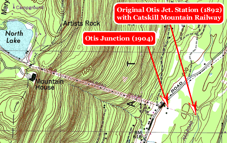
| map by Dick Makse (USGS Kaaterskill Quadrangle, 1946, photorevised 1980) | |||||||||||||
|
The profile of the Wall of Manitou is clear in this excerpt from the Kaaterskill quad. Note that both the right of way of the Otis and of the connecting Catskill Mountain Railway are clearly delineated as railroad grades on the map, despite the cessation of service in 1918. The Catskill Mountain House lasted until 1966 when it was demolished by New York State. |
|||||||||||||
|
|
|||||||||||||
|
|||||||||||||